Column文化遺産コラム
Emerging technologies for international cooperation in cultural heritage
25.03.2022
Author MAEDA Koki
Associate Fellow, Japan Center for International Cooperation in Conservation, National Research Institute for Cultural Properties, Tokyo Secretariat of the JCIC-Heritage
What comes to mind when you hear the term 'new technology'? Todays’ technology is advancing at a rapid pace and the same goes for the field of cultural heritage, where the latest techniques and machines for heritage documentation have been developed. This column will introduce part of how technologies, which have made ground-breaking advances in recent years, are being applied in the field of cultural heritage.
Share
-
New technologies in the world of cultural heritage
What do you think of when you hear the word “new technology”? You might imagine AI technology, 3D printing, hydrogen power generation, or 5G telecommunication system … Todays’ technology is advancing at a rapid pace and replacing with traditional methods in various fields. The same goes for the field of cultural heritage, where the latest techniques and machines for heritage documentation have been developed. This column will introduce part of how technologies, which have made ground-breaking advances in recent years, are being applied in the field of cultural heritage.
-
Drones/ 3D scanning/ Photogrammetry ....
Surveys and researches in cultural heritage have traditionally used analog methods. For example, in archaeological sites and historical buildings, the site information was obtained from drawings based on triangulation and specific surveying instruments while photographs and sketches were used to record the objects. These methods are important and fundamental techniques and are still used today, but those cultural heritage sites are sometimes so vast that it was extraordinarily labor-intensive and time-consuming to comprehensively document and comprehend them all. Furthermore, depending on the surrounding environment and location, it was sometimes challenging to gain an overview of the objects due to the difficulty of preparing scaffolding for the survey.
In response to this situation, new inventions such as drones and 3D scanners have come into use to overcome such difficulties. Drones, which enable filming from the air, make it easier to do documentation at heights that previously required scaffolding and tripods. 3D scanners are used to create 3D models of archaeological sites and artifacts and check survey data in various locations. 3D survey technology has already existed since before, but there has been a major development in its applicability, user-friendliness, and accuracy to record a wider variety of survey targets. In particular, the technology to measure the distance from objects using lasers, known as LiDAR, has been making remarkable strides as it is becoming possible to do documentation and creation of 3D models in heritage sites with a single tablet computer.
In addition, we have seen advances in a technology called photogrammetry, which creates 3D models by combining multiple photographic images. The biggest advantage of this technology is that it does not require any difficult technique, as you can create detailed 3D models as long as the photos of targeted objects are available. Wouldn’t it be exciting to be able to create 3D models with your smartphone even if you do not have a camera at hand?
Here is a 3D model I created by photogrammetry using photos taken with my camera.
Front facade of McEwan Hall, Edinburgh, Scotland.
-
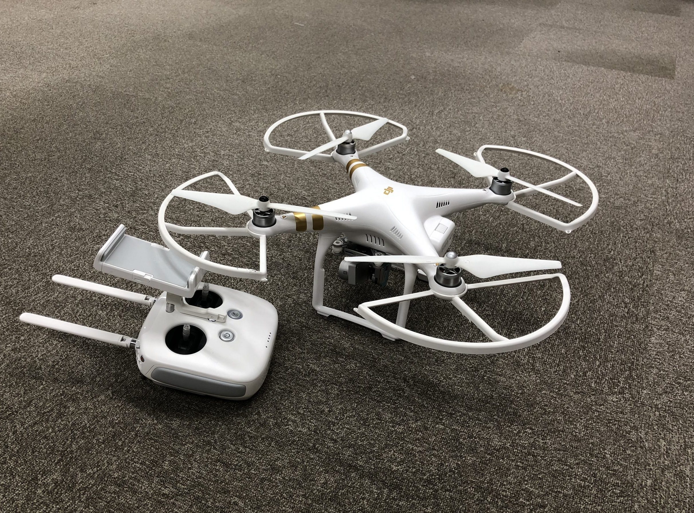
Drones used at cultural heritage sites. It is adated for remotely taking photos and videos.
-
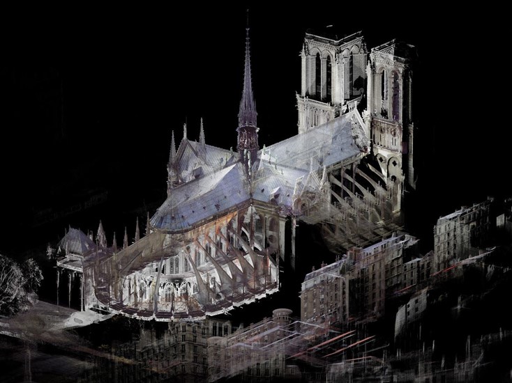
3D scan data of Notre Dame Cathedral, Paris, France. It is utilized for post-fire restoration. ©Art Graphique et Patrimoine
-
-
Field surveys /Conservation and restoration practice/ Training for professionals and students ....
Application in the field of international cooperation
The new technologies have already been used in the field of international cooperation in cultural heritage, where universities, research institutions, and NGOs take initiatives in heritage conservation abroad, often in cooperation with private companies. They are involved in various activities such as providing knowledge on the latest technologies, using them in field surveys and conservation projects, and training local experts and students (see below). Moreover, thanks to the high applicability of drones and photogrammetry, they are also utilized for surveying underwater cultural heritage, which would have caused many difficulties with only conventional methods.
■Project for the training of local personnel in 3D measurement of cultural heritage and the use of acquired data in Tikal National Park, Guatemala World Heritage Complex (Guatemala).
Organizers: Kanazawa University
Objective: Training on overview and basic theory of 3D measurement.■ International Project for the Conservation of the Borobudur Site (Indonesia).
Organizers: Ritsumeikan University, Indonesian Academy of Sciences, Borobudur Conservation Office, Nara National Research Institute for Cultural Properties.
Objective: Use of photogrammetry for field surveys and development of visualization techniques in conservation, education, and tourism aspects, etc.■ Underwater cultural heritage research and surveying (Japan, USA, Australia, Bahrain, etc.).
Organizers: Universities, other research institutions, private operators, NGOs, etc.
Objective: Efficient surveying of underwater cultural heritage and acquisition of accurate data■ Human resource development project for the protection of the Ain Dara archaeological site (Syria)
Organizers: University of Tsukuba, etc.
Objective: Surveying and recording the destruction of archaeological sites using drones and photogrammetry※The name of projects above is author’s translations from Japanese and are not official names
-
A case study of international cooperation in Cambodia
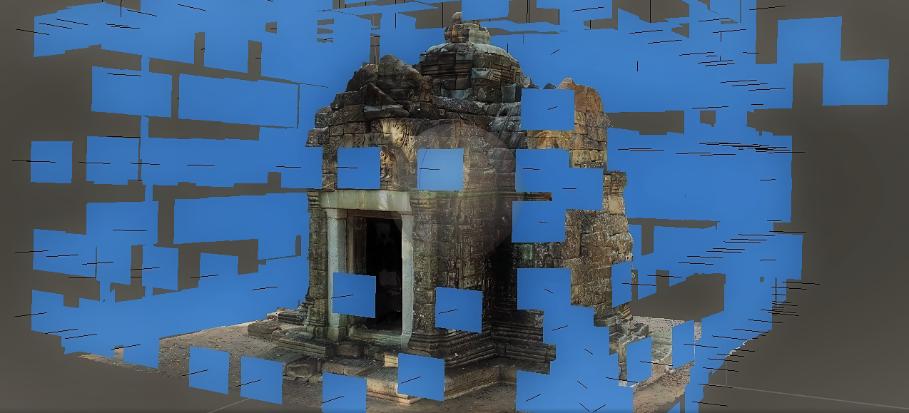
Field survey for the conservation of the Angkor Ta Nei Temple site
In Cambodia, a conservation project is underway at Ta Nei temple by the Authority for the Protection and Management of Angkor and the Region of Siem Reap (APSARA) with technical cooperation by Japan. In the latest survey carried out jointly by Japan and Cambodia, drones played an active role in surveying areas of the site in danger.
At Ta Nei temple, there was difficulty setting up scaffolding without affecting the unstable buildings and scattered stones around the site. However, aerial videos shot with a drone enabled the professionals to check the condition of the site from a bird’s eye view. As drones are susceptible to wind, they carefully maneuvered it to avoid collisions to the structure, which may damage cultural heritage sites. From the videos and photographs, it became possible to identify vegetation on top of the buildings and areas in danger of collapse.
The drone survey also made it possible to create a 3D model of the East Gate of the temple by photogrammetry for reviewing the condition of the restored structure.
-
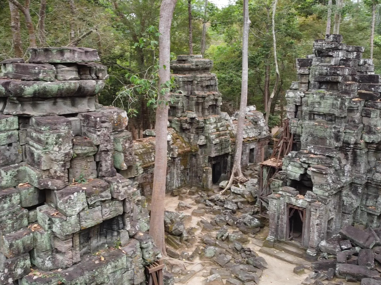
A bird view of the central temple at Ta Nei site
-
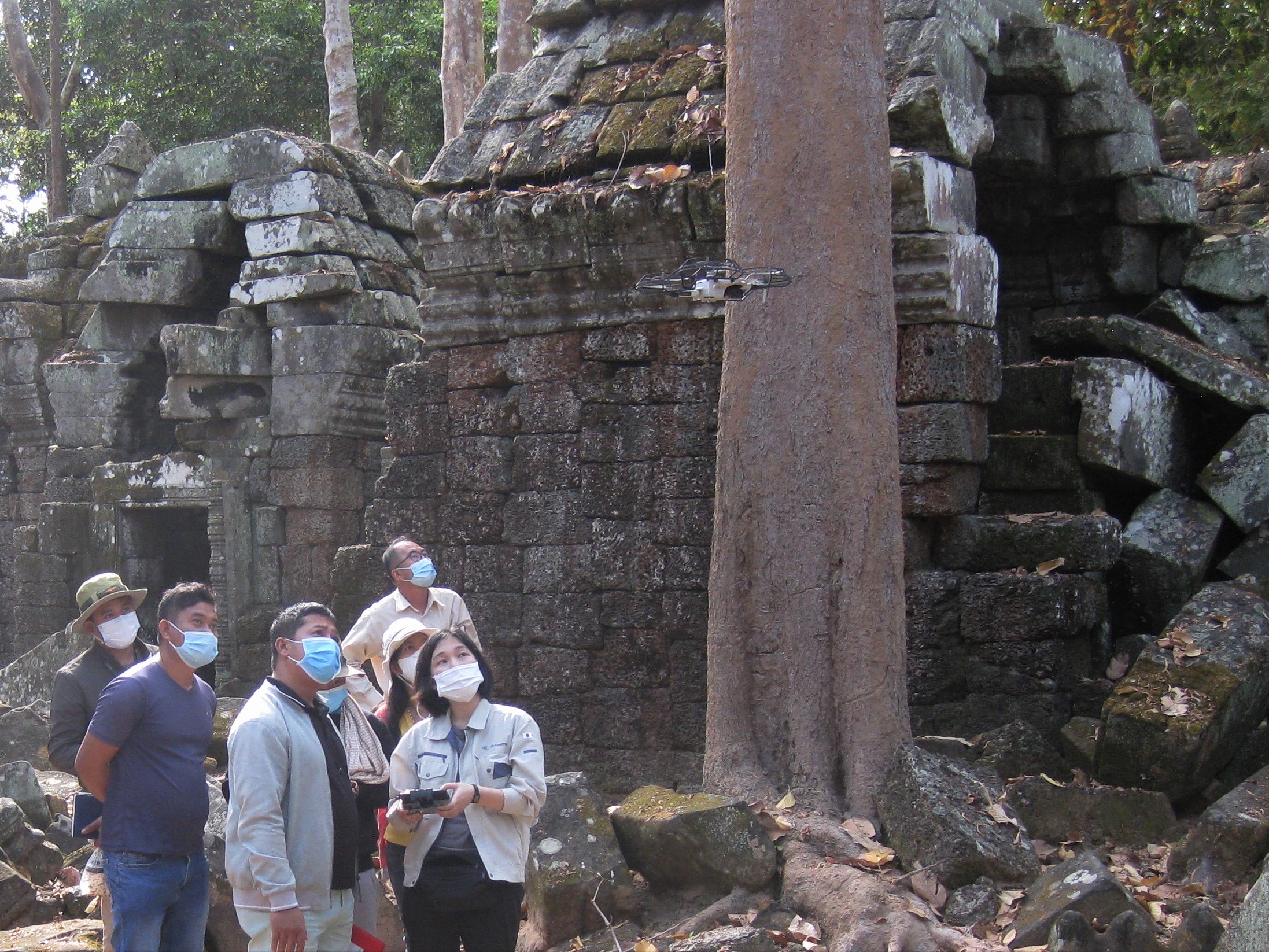
Checking the control of a drone with local officials
-
-
VR, AR and citizen engagement...
Wide variety of use and future prospects
The cultural heritage data collected by these technologies are not only significant as archives of records but also as seminal information used for a variety of purposes, including in-situ conservation and restoration practice and academic research.
The adaptation is also diversifying, with many creative initiatives such as displaying created 3D data in VR and AR as museum exhibits and online platforms for posting and sharing 3D models of local historical assets by citizens.
Therefore, continuing technological progress reflects many future potentials in the field of cultural heritage. I believe that technology will play a vital role in international cooperation in cultural heritage and will be further accelerated by the corporation of Japan, which has made technical contributions in various fields.
-
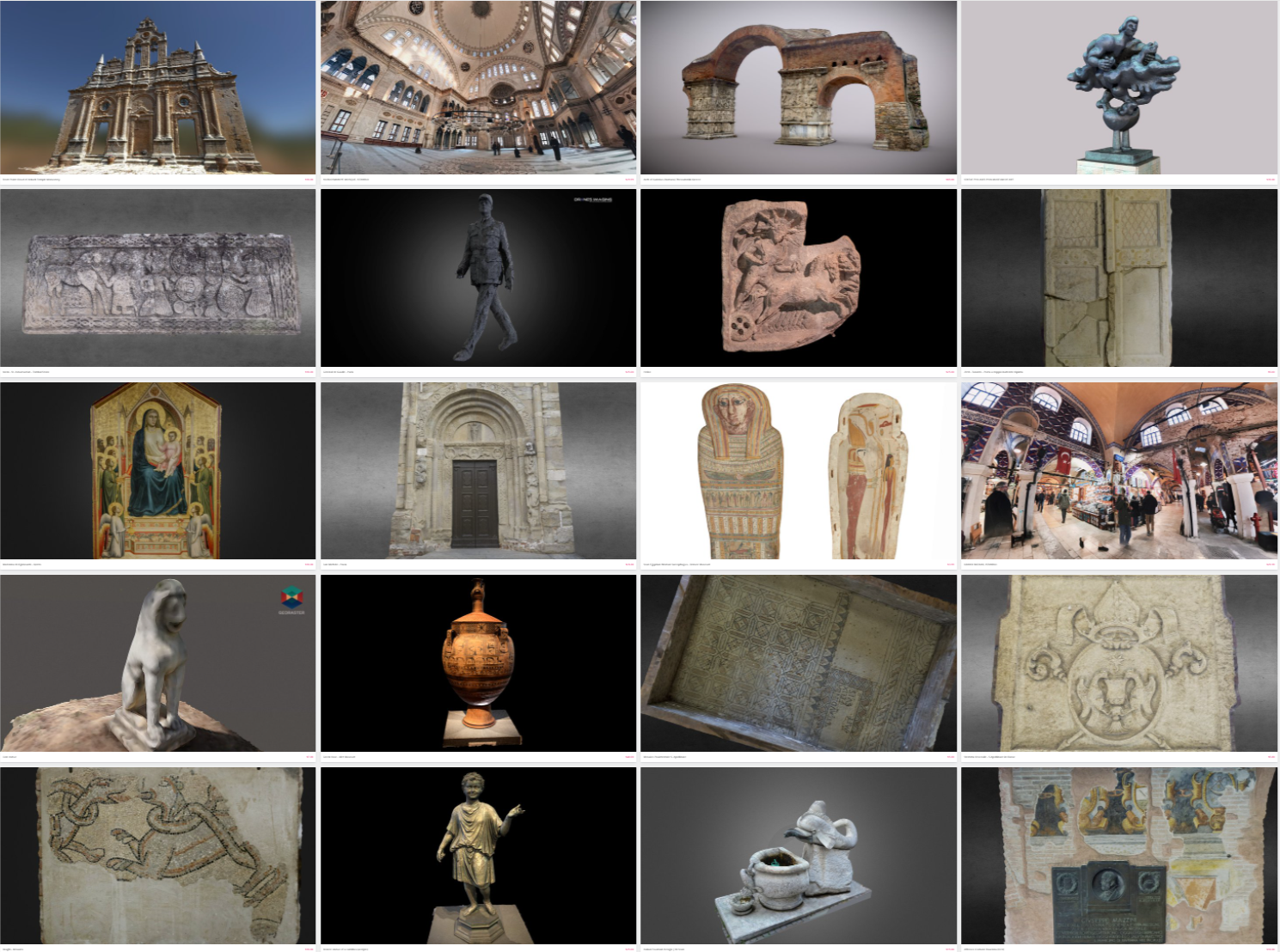
A platform for sharing 3D models of cultural heritage ©Sketchfab
-
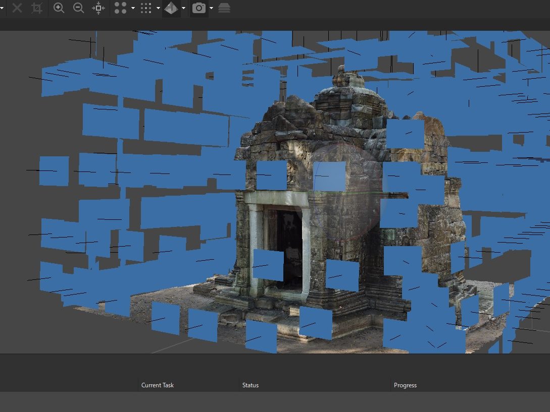
3D modelling of the Ta Nei site using photogrammetry.
-
